The first fifty miles were rather familiar turf -- south via Vancouver then the Esplanade, then onto Springwater for its entire eastbound length into Boring. Into Estacada via the usual backroad combo, including the awesome drop-in on Van Curen road (quickly goes from flat to a -14% grade, and takes you on a pencil-straight mile-long screaming stretch with no intersections). I had a goal of 50mph, but wound up about 2mph short. Drats.
Anyway, Estacada would be the last true town we saw for about a hundred miles. We took 224 (and of course the lovely detour onto Faraday Road, a freshly paved waterfront dam access road for PGE) up to Ripplebrook, which is where my familiarity with the route ended... and where the fun, which is to say thousands of feet of elevation, began.
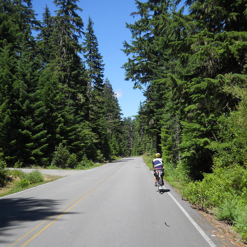
Up we went, towards Timothy Lake, gaining about two thousand feet in the next dozen miles out of the ranger station. After a very short stretch of rocky singletrack, creek crossing, and scurrying up the rather steep far side of the creek bed, the lake itself came into sight near mile ninety... and, good lord, it was beautiful. I was still feeling fairly strong and fresh, but I had to fight off thoughts of abandoning this whole silly "bike ride" business to instead go float on the lake for the remaining daylight hours.
Thankfully, the only flotation devices I had were a handful of 42mm inner tubes, so no actual water adventure was had. We rolled along a series of (paved) forest roads for the next twenty miles, including a conveniently placed water spigot, before hopping on for five miles of US-26 before turning off towards Maupin.
Wapinitia Highway was a gorgeous green road, providing 20 miles of lovely shaded descent from the 26 out towards the Deschutes River. Then, though, a crazy thing happened: the trees stopped. As a lifelong (mostly) Oregonian, I knew there WAS A big dry valley in this part of the middle of the state... I had just never explored it, let alone traveled forty miles of it on bicycle.
So, we had full sun, a hard crosswind, and many shades of tan, yellow, and brown. Interesting and beautiful, if slightly unpleasant. I think I'll stick to the green parts of Oregon.

Maupin itself was a pretty awesome little town, and I stopped at a market for my (obligatory) first corndog of the day. However, it's also at the bottom of a short and steep winding descent off the main highway, which meant that post-corndog we had to reverse course and regain about 500 feet of elevation in two miles.
Tygh Valley (mile 142) was only about ten miles away from Maupin, but I had used up most of my water in that stretch so another little deli/market stop was needed. From there, the climbing started again -- but nothing quite as forceful as the exit from Maupin. Perhaps just as unpleasant, though, was 5-mile stretch up a grade not much more than 1%, but into a stiff headwind. We formed a three-man paceline, taking quickly rotating pulls... at about 10 miles per hour. A little disheartening.
There was a ton of climbing remaining, but we were nearly back into the shaded protection of the Mt. Hood forest. It's forty miles from Tygh Valley to Government Camp, and it's rather unrelentingly uphill. Took me about 5.5 hours to cover this stretch, but it felt more like ten. The sun set on me about halfway between the two, though I did make it just far enough on NF-48 for a few awesome exposed views of the mountain, cast in a purple and orange sunset glow.
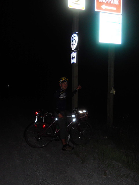
(it says Barlow Pass, elev. 4155, thanks to David for the photo)
I had a big bowl of pretty bad clam chowder at the 24-hour Huckleberry Inn at 11pm, then put on just about every clothing piece I had packed for the ten straight downhill miles on 26 into Zigzag. Traffic was minimal, but had enough big trucks and the looming threat of road debris, so I descended rather cautiously. My GT even picked up a little bit of shimmy at speed, something I'd never dealt with before, but that was mostly corrected with either a knee to the top tube or simply soft-pedaling forward (without even engaging the freehub). Still, I spent a good chunk of that stretch braking, and ended up down at the turn for Lolo Pass a minute or two behind the others.
Hwy 26 had signs indicating Portland was forty-something miles away... but, of course, our trip home wouldn't be so simple. We turned up Lolo then onto Marmot, which is a slight pleasant descent for nearly ten miles through Brightwood, before throwing a pair of mean-spiriting lumpy hills in your path before you meet up with Ten Eyck.
Then, of course, there was Bull Run and Gordon Creek. This stretch is fun but challenging as part of a 90-mile Portland-based ride; at 2am with 200 miles already on the odometer, it's something else entirely. I had paired off with David at this point, and he wound up walking most of these last two climbs, then nearly deciding to pull a late DNF and simply ride home from Hurlburt.
Thankfully, I was able to pull him into Corbett for an info control, then we zipped down into Troutdale for some 4am Shari's coffee and breakfast -- they give you a damn huge pile of biscuits and gravy for $5. The finish point was just sixteen miles away at that point, and heading in on Marine Drive as the sun rose in Portland was refreshing enough to cover that final stretch at a brisk effort and finish our ride in 25 hours, 10 minutes. 252 miles and, depending on who you ask, ~16K feet of climbing.
I can't recommend this route enough. Gorgeous, adventurous, challenging but quite doable (even with our stretch of walking and that Shari's not-quick-at-all stop, we had two spare hours before the time cutoff). A bit of a challenge to pack for, since there are some rather remote stretches and probably a 35-degree range of temperature (high 80s around Maupin, low 50s in Zigzag but felt colder). A third water bottle is a must, if only for the stretch between Tygh and Govy.
Anyway, another ten miles south back towards our neighborhoods (mine near Holgate, his in Sellwood) and it was finally shower and bedtime.
No comments:
Post a Comment