Showing posts with label Hills: Hard. Show all posts

Tuesday, March 19, 2013

Permanent #1894 -- Irma Pince


Surprisingly, my 19th registered RUSA permanent is my first which comes close to be a "true" 200K that both starts and ends in Portland.

Also surprisingly, none of the previous eighteen routes took advantage of perhaps my single-favorite stretch of road in the greater Portland area -- Pumpkin Ridge to Smoke Ranch, as seen here from a ride report a while ago.

As you can see, the best parts of the ride are unpaved; on this route, about 20 total miles on either gravel or dirt. You can certainly navigate everything on a road bike with narrow tires, but you'll have a better time with some wider rubber between your legs.

It's also a damn hilly route, with a handful of climbs competing for the title of "best part of the ride". Going up a furlong (which I learned was an eighth-mile at bar trivia yesterday) of loose gravel at 12% on Pumpkin Ridge might be a good pick, or there's a similar stretch on the paved Mountain View Road which is particularly painful since it comes just two miles after a quick control stop in Scappoose.

After Canaan Rd spits you out on Highway 30 at the Deer Island mini-market, your last 45 miles of the day will all be dead-flat. A loop around the east backside of Scappoose gives you some lovely quiet miles instead of the usual bustle of 30 (and is needed to put the route over 200K), but then it's back on the highway and returning to SE Portland.

Permanent #1893 -- Stan Shunpike


Sometimes a 100K is too short of a ride, but a 200K is too long. Oh no!

Thanks to years of hard science research, I've unearthed a solution -- an in-between distance!

This one is 133K, or 82 miles. About 35 of them are on the Springwater Corridor, so if you do this ride on a sunny weekend afternoon, expect a variety of dogs, bikes, and walkers as company.

The real heart of it, though, comes from two hilly loops east of Estacada and south of Sandy. The first takes you out on Wildcat Mountain Rd -- a lovely road which continues into the Salmon-Huckleberry Wilderness south of Mt Hood -- on mostly sustained medium-low grades until a final little 10% kicker gets you to the info control at 452nd Ave.

From there, you get to rip down the Kitzmiller Rd descent into Eagle Fern Park. Southeast of there you make a loop of George / Clausen Rd, with a 1300-foot climb in about seven miles.

Once you leave Boring, the route is minimally serviced -- Eagle Fern Park should have running water, although I've been bitten too many times by unreliable parks dept. maintenance.

Monday, March 18, 2013

Permanent #1877 -- Viktor Krum

On the opposite spectrum of hilliness from my PDX-Bremerton route, this one starts and ends in roughly the same area, but goes up and over Mt St Helens rather than the flat Washington coastline.

Wind River Rd and NF-25 provide the most gorgeous (and challenging) portions of the ride, cutting through Gifford Pinchot forest as you ride between Carson and Randle. These roads aren't maintained for winter riding -- which, depending on the year, might delay its opening all the way until June or even July.

When they are open, though, it's gorgeous... and hard. I'll spare details from the elevation profile and just say there's a big volcano there, and you ride up and over it.

The latter half of the ride is a bit more relaxed, but you still have some pleasant roads (and a bit of climbing) after Randle, going up towards Orting. The last forty or so miles uses the Interurban Trail then a variation of the official STP route to wrap up the ride in the University District.

This, of course, is also available to be used in the opposite direction (and again, no cue sheet for that way yet). There's two or three campgrounds with drinking water available as you ride through Gifford Pinchot, and a not-entirely-reliable grocery store near Swift Reservoir. For the northernmost parts -- the ones you'll likely face in the middle of the night if you started in PDX -- I'm not sure of many 24-hour food options, so pack plenty of snacks and probably a third water bottle.

I'm toying with making a Cyclos Montagnards-esque unofficial medal for Oregon or Seattle randonneurs who complete both #1876 and #1877 in a span of a couple of days, with a brevet or permanent in the middle -- maybe call it the lazy man's 1000+K. Check back later.

Sunday, March 3, 2013

Permanent #1875 -- The Bloody Baron

#1875 -- The Bloody Baron
This one is, at least in parts, positively Rapha-esque. After a straightforward route from SE Portland to Camas, you head north and, though you'll never really be more than 20 miles from the suburbs, you'll feel like you're in the middle of nowhere.

You use L-1000 and Dole Valley Rd to carve a winding path up towards Amboy, in the foothills of Larch Mountain (no, not THAT Larch Mountain, nor the other Larch which you see signs for off OR-6). This route tops out at just under 2,000 feet of elevation, and my favorite, though usually inaccurate, route mapping site guesses there's over 6,000 feet of climbing in the middle fifty miles of this route.

There really isn't much civilization between Camas and Yacolt (the small town just south of the turnaround in Amboy), and with some rather rough gravel roads you should plan accordingly with clothing, food, and tools. I think the only quasi-commercial building you'll pass over a 20-ish mile stretch is a jail, and that's not exactly where you want to pull up to beg to use their phone if you have a mechanical failure.

There's about 15 miles of gravel in each direction -- heading north, they're mostly (but not entirely) downhill (with some rather steep grades in spots); on the return trip, you get, well, the opposite. Different riders will find one or the other to be preferable. I'd recommend riding it with at least 30mm tires, and will be using 40+mm myself, though if you're comfortable and familiar with gravel on a road bike it's doable on anything.

So -- if you've grown tired of Dixie Mountain and Otto Miller, head up over the I-205 bridge and check this one out.

Monday, October 15, 2012

Permanent #1691 -- Grawp


Beautiful, isn't it?

This is my twelfth registered permanent, a multiday whopper designed to take advantage of two things: first, a RUSA rule which relaxes the time limit for rides >700K; and second, my grandmother's big lovely house in Oceanside that would serve perfectly as a mid-ride overnight rest stop.

Thus, time to introduce: GRAWP.
It's enormous and awesome -- the name selection was pretty easy.

This is the end product of basically throwing a bunch of my favorite roads onto a map and finding a way to get them to stick together.

The initial southwest-bound crawl out of Portland is pretty straightforward -- taking well-traveled roads through Oregon City and Canby, then joining up with the official Willamette Valley scenic bike route and crossing over the Independence Bridge.

I aped the Independence-Kings Valley connection from Joshua's 600, then used the gravel Hoskins Rd to get over to Logsden which I last traveled on 2011's coast 600K. The seventy or so following miles are almost the same as what was used for Susan's ride, just reversed and extended out to Bear Creek Rd rather than a longish stretch of Hwy 101 towards Pacific City.

In Pacific City, you make a U-turn to go back and take Little Nestucca River Rd and Hebo Rd up to Willamina (this stretch lifted from the Three Capes 300K). Whereas that ride ducks back towards Forest Grove, mine sends you straight north out of Willamina for the toughest climb of the ride, towards Bible Creek Rd and a connection with Nestucca River Rd.

Going north over Cape Lookout is only about a 600-foot climb, nothing too outrageous, but watch for poorly maintained pavement. After passing through Netarts and Oceanside, my same comment applies for Cape Meares.

Stock up on food at the 24-hour (edit: closes at 1am) Tillamook Safeway, since you'll have a rather remote stretch on Miami-Foley Rd then the newly reopened Foss Rd (now with intact bridge!). Foss is about eighteen miles of rough gravel -- just what everyone wants to see at mile 320!

There's a restaurant and market on the short stretch of Highway 26 you need to use to connect to Hwy 103, which will likely be much-needed after the gravel stretch. Or, you can make that stop a relatively quick one and instead get a longer sit-down meal at the always-popular Birkenfeld store, about twenty miles later.

Unfortunately, the route just wasn't quite long enough if I used the Banks-Vernonia Trail, so instead you take a longer way back via Timber Rd. The final stretch is straightforward and well-used -- Clapshaw Hill, West Union, Laidlaw, Thompson, and Cornell.

Then, voilà, 712K done!

David and I will be riding this starting 5pm on Friday (yes, that's October 20). Overnight lows in the 40s, 30% chance of rain in most places along the route. Should be... interesting, if nothing else.

Monday, August 27, 2012

Permanent #1649 -- Horace Slughorn


I had a nice present waiting in my inbox after this weekend's 600K (report forthcoming) -- two new permanent approvals.

It's a shame that I'm in no shape to ride more than a few miles today, though, because this one in particular looks like an awesome one -- lots of dirt and gravel and climbs and descents and the other good things that make for great bike rides.

This covers the entire length of both Leif Erickson trail and Saltzman Road as they cut through Forest Park. Each stretch is very frequently used by roadies and is certainly "doable" on 23mm tires, but would probably be more enjoyable with extra cushioning. Bring a decent set of brakes, too -- particularly for the easternmost segment of Saltzman after it crosses Leif.

The rest of the route (which, as a first for me, comes in at a neat and perfectly even 100km) sends you on a few of the somewhat "hidden", lesser-used roads of deep northwest: Old Germantown, Kaiser, Moreland, and Pederson.

One downside of this rather circuitous route is that it needs seven info control stops, but there's certainly enough climbing so you won't mind being forced to briefly stop in a few spots. If you need to pick up food or water, the best bet is probably the store at the intersection of Skyline and Cornelius Pass, which you'll pass at mile 24 & 43. They even have a water spigot in front of their building which is open to cyclists, but be sure to make an actual snack purchase every now and then to show a little appreciation.

Sunday, August 12, 2012

Permanent #1613 -- Elphias Doge


I've got a big soft spot in my heart for the state on the other side of the Columbia River. My first two 100K routes both head up into Washington, and I feel Portland roadies in general do themselves a disservice by rarely riding north for their adventures.

This particular permanent was inspired by my experiences on this spring's flèche, as seen here and here, and I set out looking for a way to turn a 400+ mile Eugene-Olympia-Portland extravaganza into a more manageable Portland-based route.

The result is what you see -- north through La Center, Kalama, and Kelso, over the Lewis & Clark Bridge (still yucky), then up Apiary Road before ending up back in familiar randonneur territory in Vernonia.

The first thirty miles or so are exactly the same as on my Luna Lovegood populaire, and for good reason -- in Google Maps, you might see that stretch of road and think bah outer Vancouver sprawl crap, but it's actually an awesome stretch of farmland with some fairly robust rollers to get your legs ready for this super-sized course.

When we rode Olympia-Portland after the flèche, we climbed the entirety of Green Mountain Road south of Kalama, all the way up to 1700 feet with several stretches graded above 10%. This way, though, cuts off about half that elevation, and instead cuts back towards I-5. RWGPS suggests there's a 14% portion of the climb near the top, though, so it'll certainly still make you work.

After that, you can regain some energy in beautiful downtown Kalama then ride the last ten or so miles of the day on the Washington side of the river on relatively low-traffic old roads paralleling the interstate.

There's nothing particularly exciting in Rainier or Longview, but plenty of options for refueling. There is a stretch of almost exactly thirty miles between Rainier and Vernonia without any stores (there is a campground roughly halfway, not sure what's inside), so plan accordingly.

Coming from the north, Apiary Road is a little unkind -- two false summits, including the unpleasant experience of climbing up to 1000 feet, feeling like you're done as you drop down to 600, then turning a corner and going up towards Camp Wilkerson at 1200.

After that, though, most of your day's climbing is done, and the Shell Station in Vernonia is always there to provide friendly service and hot fried food. Depending on your start time, season, and weather, you'll probably get onto the Banks-Vernonia trail in pleasant low-traffic hours, then take Zion Church and some back roads east to find the big Forest Grove-Hillsboro-Beaverton sprawl. The last 20 miles is a straightforward series of well-traveled west side bike commuter routes, finally dumping you into Portland city limits via the Highway 26 bike path.

239km, 148 miles, just under sixteen hours upper time limit. Ride it!

Thursday, July 26, 2012

Permanent #1595 -- Pomona Sprout

This... is a fairly hard one. The raw mileage/elevation doesn't really do it justice -- the vast majority of elevation is crammed into the middle 35 miles, and the course has a nasty habit of punching you in the stomach with a series of damn steep ramps.

I did an inaugural ride of the route yesterday with David Parsons, who as usual has a nice set of photos available here.

The start point is again right near my house on SE Holgate, and the first ten miles are easy enough -- over the Bybee rail bridge and onto Springwater Corridor. From there, you have a somewhat unpleasant stretch on Foster and Tillstrom (moderate traffic, minimal shoulder), but they're a necessary evil to find the start of Borges Road.

The fact that Borges -- if you have no idea how to pronounce Spanish -- rhymes with gorgeous is quite apt. This is a wonderfully remote and shaded stretch of three miles, and you'll completely forget about all the greater Portland area suburban sprawl just a few miles away in any direction.

Of course, Borges is also the first climb of the day -- the peak is actually the ride's highest point, but it's relatively moderate and pleasant. Or, perhaps it just felt that way since I had relatively fresh legs. As a bonus, I stopped halfway up to gawk at a trio of turkey vultures which had just landed in the branches above our heads.

Speaking of apt names, Sunshine Valley Road is next. It's still nice and quiet, a little lumpy but never gaining or losing more than 150 feet of elevation at a time.

After a quick stop in Boring, you're back familiar OR Rando territory by taking Richey Rd to Kelso and then Amisigger, which drops you down to the Clackamas River via an awesome 2-mile descent. No shoulder, but the pavement is even and the turns are gradual so you'll have no problem hitting 35 and taking the full lane.

Take Bakers Ferry Road over the river, then a left onto Eaden for four more awesome quiet countryside miles... followed by a short stretch of 10% grade before ending up on Fischers Mill, followed by a fairly mild stretch through Redland which connects you to...

Maplelane Road! It's a great short, lazy s-shaped sweeping descent, followed by a hellish half-mile climb that's 12% at its worst spot. Oh, and there's a camel at roadside, too.

Thankfully, once you turn off Maplelane, there's only one notable climb left for the last 25 miles. You drop down almost all the way into Oregon City, but back out again via Holcomb and then onto Front Ave. Front becomes Forsythe, then -- unsurprisingly -- goes up, up, up. On paper, it's nothing too serious, but you will almost certainly be feeling the ill effects of the day's previous hills at this point.

You're rewarded, though, with a fantastic descent on Gronlund, back down to the banks of the Clackamas to turn back west for Oregon City, then River Road through Milwaukie and back into SE Portland.

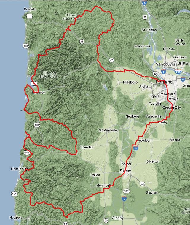
David and I finished in 5:38, including about a 20-minute Taco Bell visit with nine miles remaining but no other significant on-course stops. Could probably do a 4:45ish finish on another day, with no Taco Bell and a more masochistic approach to the hills... or I could pack some more snacks and take the full 6:44 maximum time limit. It'd be a great ride either way.

Sunday, July 15, 2012

Permanent #1585 -- Filius Flitwick

This one is a bit of a challenge -- starts off quickly by taking you up through Washington Park and past the zoo, then almost all the way north on Skyline before dropping back down into North Plains via Moreland/Solberger (3K feet of elevation in first 28 miles). The next stretch is quite a bit more mild, though, taking familiar OR Randonneurs roads through Forest Grove then south to Carlton (mile 65).

You'll probably want to stock up on snacks and water here, since there's no services available for the next 45 miles, and you'll be tackling one of the tougher coast range passes in northern Oregon. Main Street becomes Meadow Lake Road as you go west out of town. You get a few flat miles before the real fun begins -- from ~350 feet of elevation at milepoint 70, all the way up to just under 2,000 feet by mile 79.

At about that point, you go by McGuire Reservior (it'll look damn tempting for a dip on a hot summer day, but the big tall chainlink fence around it tells you otherwise) and start to follow Nestucca River Road for most of the way until you reach Highway 101. There's a few campgrounds along the way (may or may not have toilets or potable water), and one three-mile stretch of gravel around mile 90 that's, in my experience, fairly hard-packed but also pothole-y.

You rejoin civilization of sorts in the lovely town of Beaver, OR. A Shell station/market is probably your best bet for any supplies you might need for the last twenty miles of the day (there's a few other businesses, but the Shell is the only one I've seen be consistently open for business).

Three-ish miles north on 101, then left onto Sandlake Road... which means, of course, a climb over Cape Lookout. Not too hard, but it's enough to push your day's total elevation gain over 10K so it might not be too enjoyable. From there, a descent down to Netarts Bay, then six flat waterfront miles into the endpoint in Netarts, OR.